Bam
Intro
Located in Kerman province, Bam sits near routes connecting southeastern Iran to central and eastern corridors. Its oasis geography made it a natural stopover and control point in otherwise arid terrain.
Background
Bam’s relevance historically derived from its position on caravan routes and agricultural base. In the modern era, its strategic meaning shifted toward infrastructure resilience, inland redundancy, and corridor stability following catastrophic disruption.
History
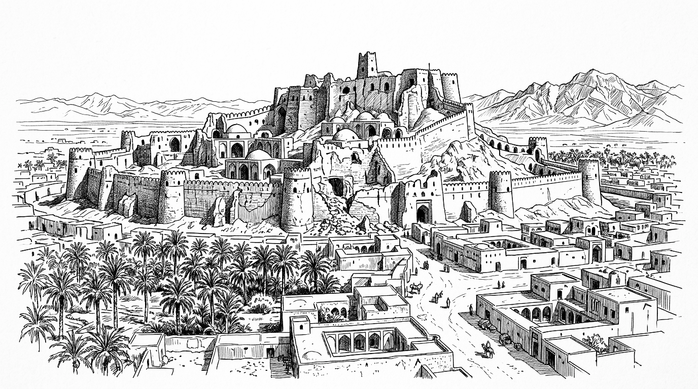
Bam’s identity was historically defined by the Arg-e Bam, a vast mud-brick citadel and one of the largest adobe structures in the world, which made the city a fortified oasis and caravan hub on the desert routes of southeastern Iran. The city sustained an agricultural economy based on date palms through the Safavid and Qajar periods.
On 26 December 2003 a catastrophic earthquake struck Bam, killing between 26,000 and 43,000 people and destroying the historic citadel and much of the modern city in under 30 seconds. International reconstruction assistance rebuilt the urban fabric, and the Arg-e Bam has been partially restored as a UNESCO World Heritage Site.
Present Day
Today Bam functions as a rebuilt regional centre with improved infrastructure standards. Its strategic relevance lies in inland corridor continuity, disaster-response doctrine, and maintaining population nodes in southeastern Iran.
Future Outlook
Map
Articles
No results found.
Event Timeline
No results found.